
Yarmouth ZIP Delivery Areas
The county's village table confirms three ZIP areas serving Yarmouth. They are delivery areas, not separate municipalities or a resident roll. Bass River shares a ZIP with South Yarmouth, while West Yarmouth and Yarmouth Port have their own verified delivery labels. Use the exact Yarmouth address to check a result, because a street name alone does not settle the delivery ZIP or the record custodian's indexing name.
| Yarmouth ZIP | Delivery areas | Post-office label | Record-search caution |
|---|---|---|---|
| 02664 | South Yarmouth and Bass River | South Yarmouth / Bass River local area | One ZIP covers both labels; town-indexed records can still use Yarmouth. |
| 02673 | West Yarmouth | West Yarmouth | Verify the complete delivery address with USPS. |
| 02675 | Yarmouth Port | Yarmouth Port | Do not infer the ZIP from a northside street name alone. |
No official source in the research found a separate Yarmouth PO-box-only ZIP, a unique institutional ZIP, or a documented ZIP realignment date. Keeping that Yarmouth gap visible avoids turning a local label into a false boundary. A Yarmouth directory search should preserve both the postal label and the municipal name needed by the next record system.
The Barnstable County villages and ZIPs table supplies the verified Yarmouth delivery-area comparison.
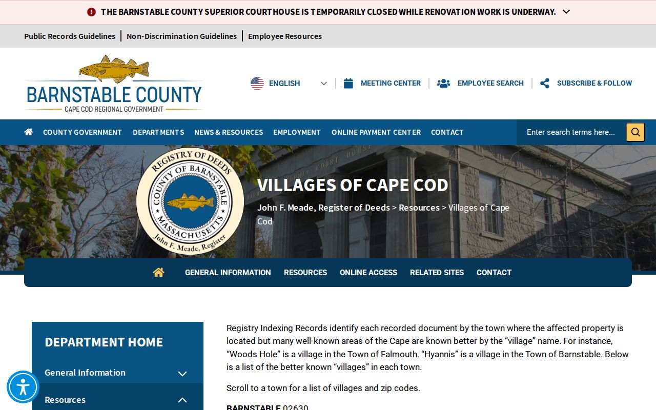
The county table shows why Bass River, South Yarmouth, West Yarmouth, and Yarmouth Port should be searched as labels within Yarmouth, not as separate town governments.
Yarmouth 02664 Delivery Area
ZIP 02664 covers South Yarmouth and the Bass River local area. The shared ZIP is a useful reminder that a postal or village name may not match the name selected by a town, county, or state index. A Yarmouth deed search can use Yarmouth as the municipality, while a current mailing label or printed directory may use South Yarmouth or Bass River. Search each relevant form of the Yarmouth address, then preserve the spelling that appears on the record.
The distinction is especially useful near local names such as Bass River, Lewis Bay, beach associations, or Great Island. Those descriptions can be meaningful neighborhood vocabulary, yet they do not change the legal municipality used in assessor and Registry work. A parcel popup may also identify water, right-of-way, common land, or a private-road polygon rather than a residential parcel.
Yarmouth 02673 and 02675
West Yarmouth uses 02673 and Yarmouth Port uses 02675 in the county table. The exact delivery address still controls. A street can have number ranges, odd or even sides, a precinct, and a ZIP assignment that must be checked together. The Yarmouth precinct street table supplies those local administrative fields, including low and high house numbers and side designations.
When a number is not present in that table, do not interpolate from a nearby address. Use USPS or ask the Town Clerk for help with the town administrative table. The research did not establish a complete Yarmouth ZIP-to-street master list beyond the located precinct PDF. A specific address should therefore be marked as needing exact verification rather than assigned a guessed ZIP.
Verify a Yarmouth ZIP
The USPS ZIP Code Lookup is the authoritative delivery check for a full Yarmouth address or a city and state query. Its dynamic field labels and result limits were not captured in the research, so use the controls displayed in the live service rather than assuming a fixed form layout. USPS answers the Yarmouth delivery question at lookup time. It does not establish a parcel boundary, a town limit, title, or a list of people at an address.
- Enter the complete Yarmouth street address in USPS, or use its city and state mode when the full address is not yet known.
- Save the returned ZIP and postal locality as a dated delivery result.
- Compare the house number and side of street with the town precinct street table.
- Keep Yarmouth as the municipal search term for assessor and Registry work, even when USPS returns a village label.
- Run the exact situs address in Vision and GIS to obtain the parcel identifiers.
- Use a name, date of birth, and residential ZIP only for the state voter-status question, not as a ZIP-wide browser.
The USPS lookup interface is the delivery-verification source used before a Yarmouth ZIP result is carried into Yarmouth property or town records.
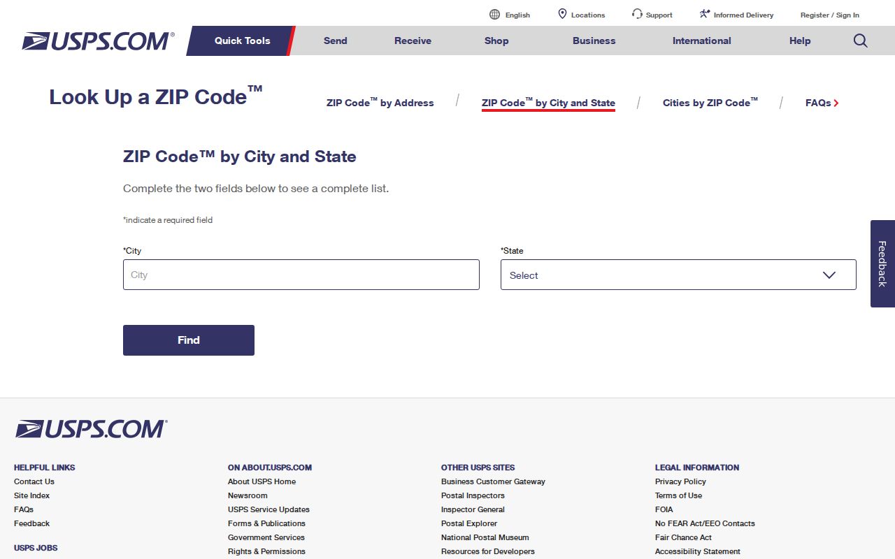
The postal response can narrow a Yarmouth address accurately, but it should remain separate from the ownership, mapping, and voter-record questions that follow.
Find Records by Yarmouth ZIP
A Yarmouth ZIP directory can narrow a known address, but the local property portal does not offer ZIP as an exposed search mode. Vision lists Address, Owner, Acct#, MBLU, and PID. Use USPS and the Yarmouth precinct table to resolve the Yarmouth address first, then run Address or MBLU in Yarmouth Vision property search. The Yarmouth assessor card may show a situs address, owner or co-owner, and a tax-mail address. Those fields can differ, and a tax-mail ZIP does not identify a person at the parcel.
Massachusetts voter status search is ZIP-capable in a much narrower way. It requires the registered first and last name, date of birth, five-digit residential ZIP, and an acknowledgment that the search is intended for individual status. It is not a Yarmouth ZIP roster. The exact fields are shown below because entering a wrong ZIP or a former ZIP can affect an individual status result.
| Voter-status field | Required | Yarmouth ZIP use |
|---|---|---|
| First Name and Last Name | Yes | Use the name as registered; nickname guidance is available from the state. |
| Date of Birth, month, day, and year | Yes | All three selections are required for the individual status request. |
| Residential ZIP | Yes | Enter five digits. An old ZIP may be needed after a move. |
| Agreement checkbox | Yes | Acknowledge the statement displayed by the official search. |
| Search or Clear | No | Submit or reset controls displayed by the official form. |
For a dated local voter-list question, contact the Yarmouth Town Clerk at 1146 Route 28, South Yarmouth, 508-398-2231 ext. 1216. Make a written request that names the Yarmouth list date, desired public fields, and electronic format. The Yarmouth clerk can explain whether inspection, an extract, or paper copies are available and what fields are withheld.
Note: A voter registration application or status response is not proof that every person at a Yarmouth address currently resides there.
Yarmouth Parcel Records by ZIP
Once a ZIP has narrowed a Yarmouth address, the Yarmouth GIS viewer can identify the parcel and the Barnstable County Registry of Deeds can trace a title record. Yarmouth GIS data is for assessing and environmental context and carries a non-legal-use warning. MassGIS data offers a second parcel-layer check, including `POLY_TYPE` values that distinguish fee parcels from water, road, and other shapes. Neither Yarmouth map resolves title on its own.
For owner history, record the assessor MBLU or PID, find the current deed by grantor or grantee, then follow the parties and book/page or document numbers backward. The Registry offers free online index and image research for later material, while early records and oversized plans can require office assistance. Research images are not official copies; the Registry describes a $1-per-page clean print and a print-cart payment process. Its office at 3195 Main Street in Barnstable and phone line, 508-362-7733, are the in-person and telephone fallback channels.
When the ZIP has been narrowed to one address and a fuller named-street trail is needed, use the Yarmouth street directory workflow for the address, parcel, map, and deed sequence.
Yarmouth Delivery Boundaries
A ZIP is delivery geography, not the same thing as a parcel, precinct, village, or town boundary. In Yarmouth, Bass River shares 02664 with South Yarmouth, and a postal locality can differ from the municipality used by the Registry or town offices. The Yarmouth precinct table adds house-number range and side information, while Yarmouth deed records may use a legal description or older street wording. Treat each Yarmouth geography as its own field and compare them only for the question at hand.
- ZIP
- A postal delivery area used to route mail. It is not a legal property boundary.
- ZIP+4
- An added delivery detail attached to a ZIP for a more specific mail route or address segment.
- PO-box ZIP
- A ZIP used for post-office boxes. No separate Yarmouth example was confirmed in the research.
- Unique ZIP
- A ZIP assigned to one organization or institution. No separate Yarmouth example was confirmed in the research.
- Carrier route
- A postal delivery sequence. It should not be treated as a town, parcel, or voter boundary.
Boundary check. Preserve the USPS delivery result, town name, parcel identifier, and deed description as separate facts. A matching label does not make them the same geography.
Yarmouth ZIPs in Historic Records
Modern ZIPs do not belong in nineteenth-century directory or deed searches. The State Library verifies Yarmouth directories for 1895 and 1901, and NARA lists regional volumes with Yarmouth material for 1903, 1908, 1926, and 1929. Search the Yarmouth village, street, and number as printed in that edition. A historical Yarmouth address can then be cross-referenced to a current ZIP only as a modern delivery aid, not as part of the original record.
Yarmouth's record geography also carries the 1827 Barnstable courthouse fire. It destroyed 93 of 94 land-record volumes, and the Town Books created under the 1828 reconstruction act can be important when an early deed sequence stops. A missing old entry may reflect a records gap, not the absence of a property or family connection. Use the Registry, local history sources, maps, and dated directories together, while keeping each source's date and label intact.
Note: No official source located a full historical ZIP-realignment timeline for Yarmouth, so exact current USPS verification remains the safe delivery answer.